Why a Rhine River Gauge at Minus Six Centimetres Moved Fuel Prices
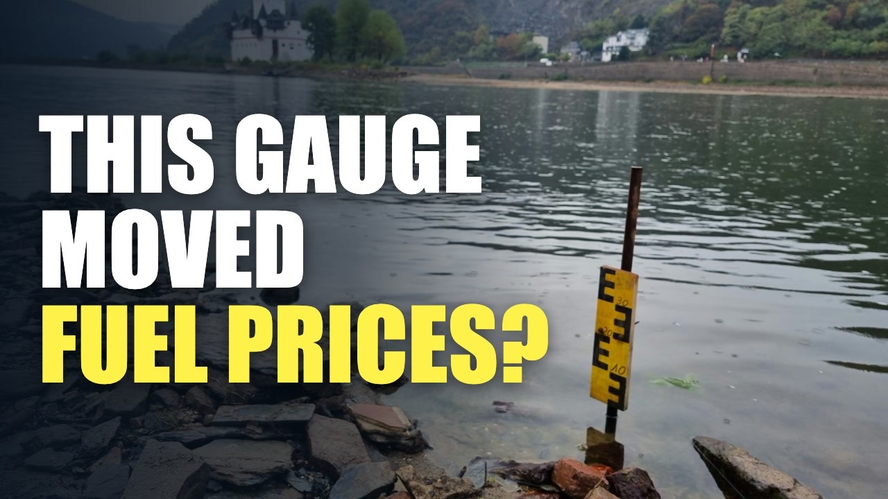
On 1 October 2026 the Rhine gauge at Kaub read minus six centimetres, the lowest it has ever recorded (raw, not yet validated data). Weeks earlier, as the river fell, Switzerland had released emergency fuel stocks. This video follows the chain from one measuring post in Germany's Middle Rhine gorge to barge loads, freight rates, Swiss heating oil and German factories, and separates what is confirmed from what is still uncertain.
This article is the full narration of the video. Watch on YouTube
A fuel reserve and a river
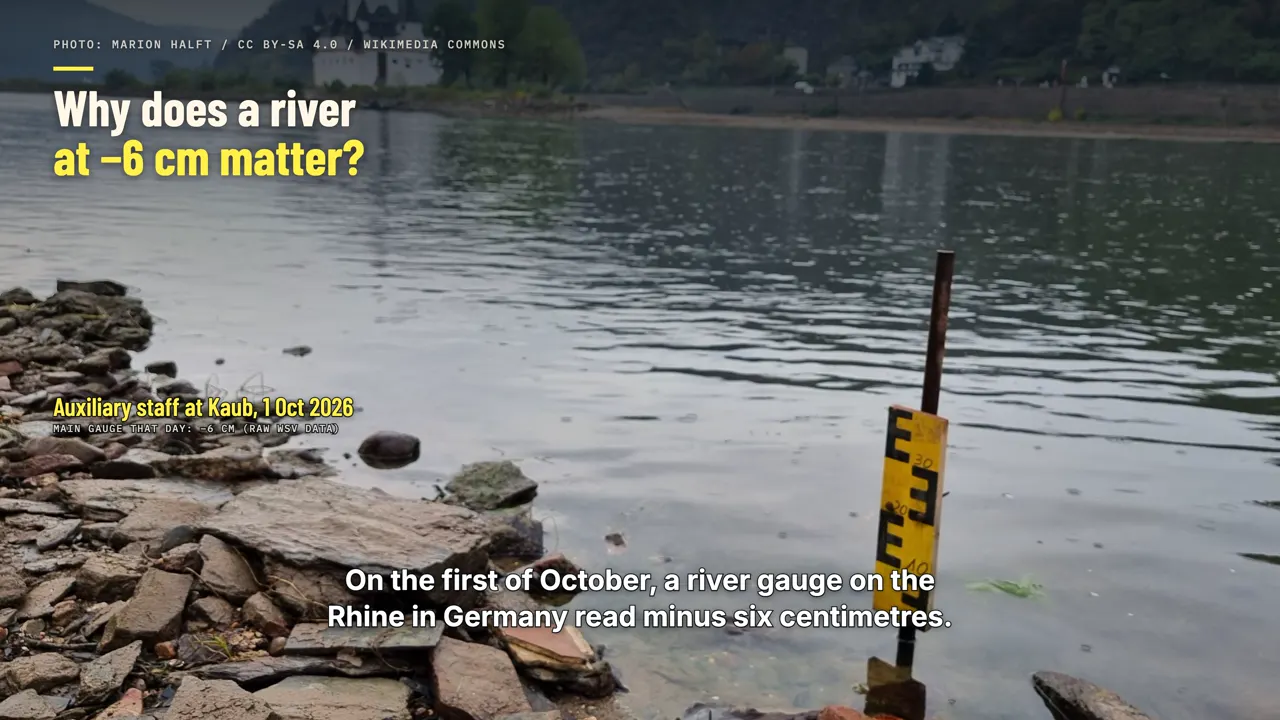
On the first of October, a river gauge on the Rhine in Germany read minus six centimetres. At levels like that, the cargo ships that carry fuel up the river can load only a small part of what they normally carry. Weeks earlier, as the river fell, Switzerland had already opened its emergency fuel reserves.
The country keeps months of petrol, diesel and heating oil in compulsory stocks, and it rarely draws on them. This time the government allowed companies to release up to thirty thousand cubic metres of diesel, and the same amount of petrol.
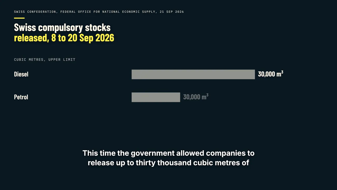
One reason was a two-week breakdown at the country's only refinery. The other was a river in Germany that had fallen so low that fuel barges could barely get through. It was the lowest reading this gauge has recorded, and it links a river in Germany to fuel prices in Switzerland and to factories along the way.
The bottleneck
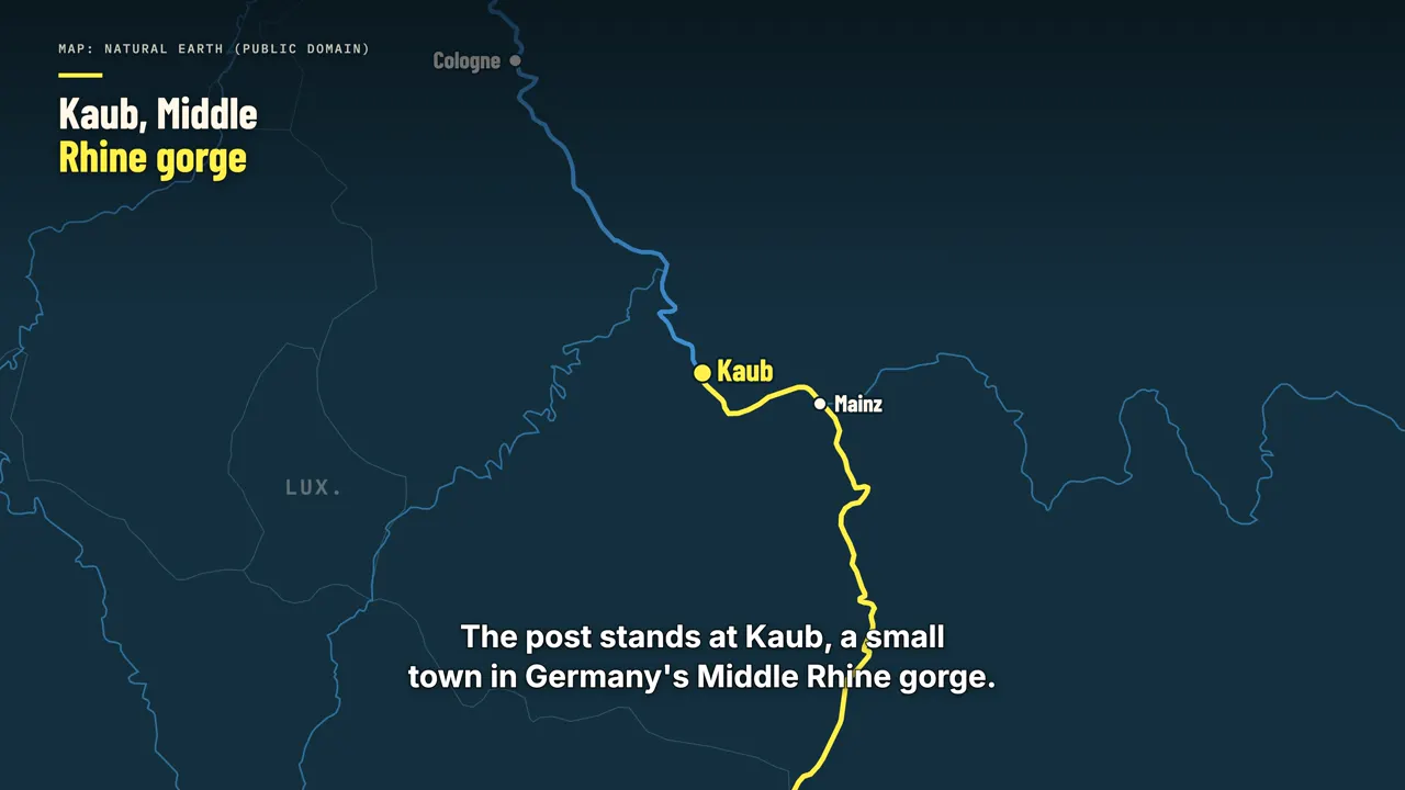
The post stands at Kaub, a small town in Germany's Middle Rhine gorge. Ships carrying cargo from Rotterdam and Antwerp up to Mannheim, Ludwigshafen, Karlsruhe or Basel all have to pass it. Here the shipping channel is especially shallow, so Kaub sets the limit for traffic to the
whole upper river. Kaub sits inside the gorge between Rüdesheim and St. Goar, the stretch that includes the Loreley rock. When the channel there is only about one and a half metres deep or less,
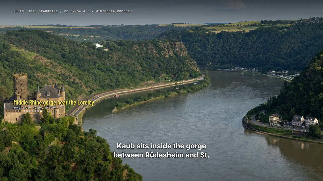
most ships can no longer get through, according to the German news agency dpa. Barge operators and freight forwarders price their cargo against this one reading.
What minus six means

Minus six does not mean the river is empty. The gauge measures the water level against a fixed reference mark, not the depth of the water. The depth that ships can rely on in the channel is roughly the reading plus one hundred and
thirteen centimetres. So on the first of October, the guaranteed channel was only about one metre and seven centimetres deep. In an average year the gauge at Kaub reads about two metres, which means a channel more than three metres deep.
The previous official record low was twenty-five centimetres, set in October 2018. This year the Rhine broke that mark in early August, fell to seven centimetres on August seventeenth, and after a brief recovery dropped again in late September.
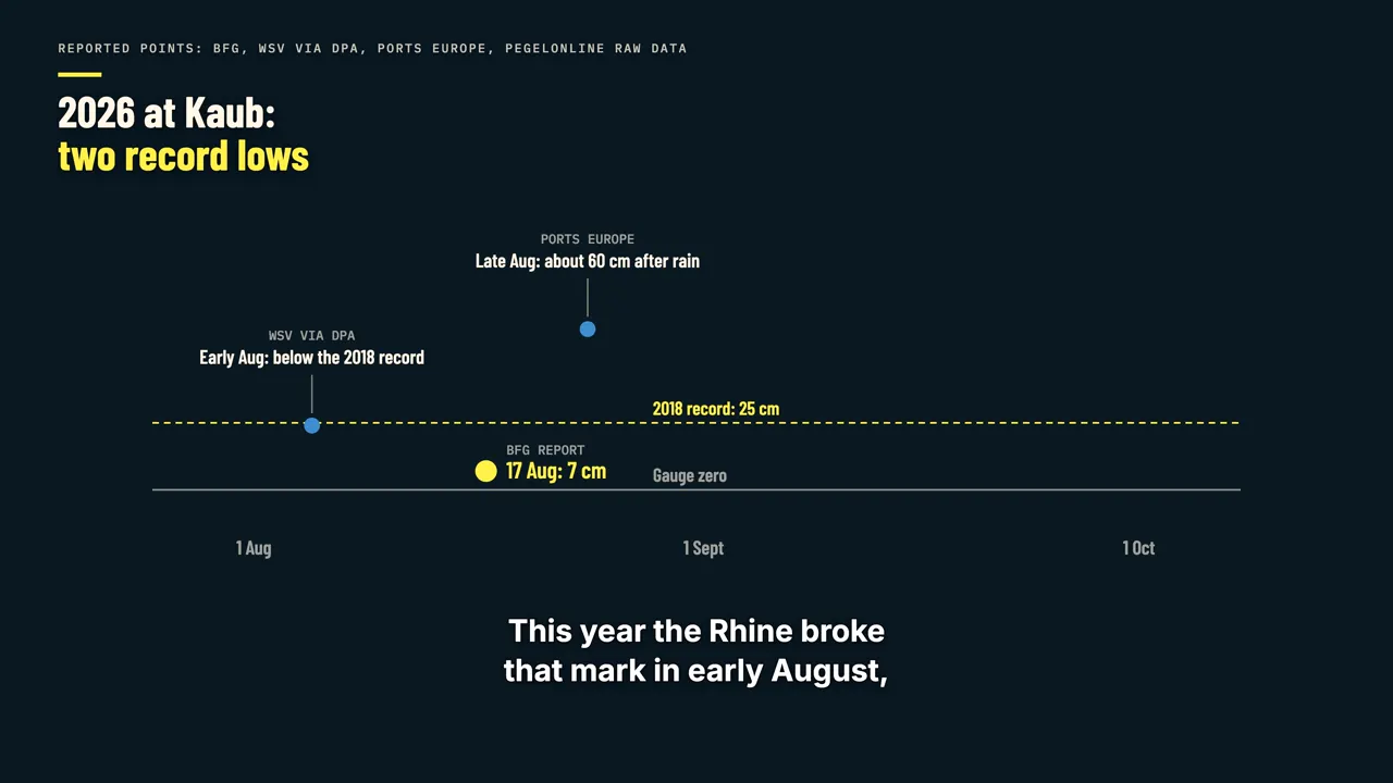
The 2026 readings are still raw data that Germany's waterways agency has not yet validated. Kaub was not alone: further downstream, the gauge at Düsseldorf also read minus six centimetres on the same day. An economist at the German Economic Institute in Cologne described the Rhine as effectively
split in two, with the middle and upper river cut off from Duisburg and Rotterdam.
Why depth limits cargo
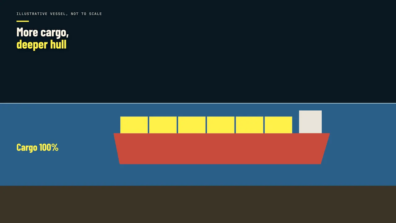
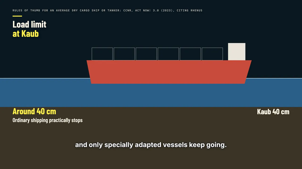
Depth matters because a loaded ship sits lower in the water. The heavier the cargo, the deeper the hull, so in shallow water a barge can carry only part of a full load. The commission that oversees shipping on the Rhine has published industry rules of thumb for how much. For an average dry cargo ship or tanker, capacity falls to about half once Kaub drops below
one hundred and thirty-four centimetres. Below seventy-two, it falls to a quarter. Below forty-four, to about fifteen percent. At around forty centimetres, ordinary inland shipping practically stops,
and only specially adapted vessels keep going. Container ships face the same arithmetic. The commission cites a container ship that carries two hundred and eight standard containers in deep water, but only a quarter of that load when Kaub reads seventy-five centimetres.
At fifty-five centimetres it can take about one sixth, so six ships are needed to move what one would normally carry. This autumn the gauge spent days below zero. According to Bloomberg, by late September Kaub had been below seventy-eight centimetres on
seventy-four days this year, compared with forty-one days in 2022.
The price of ship space
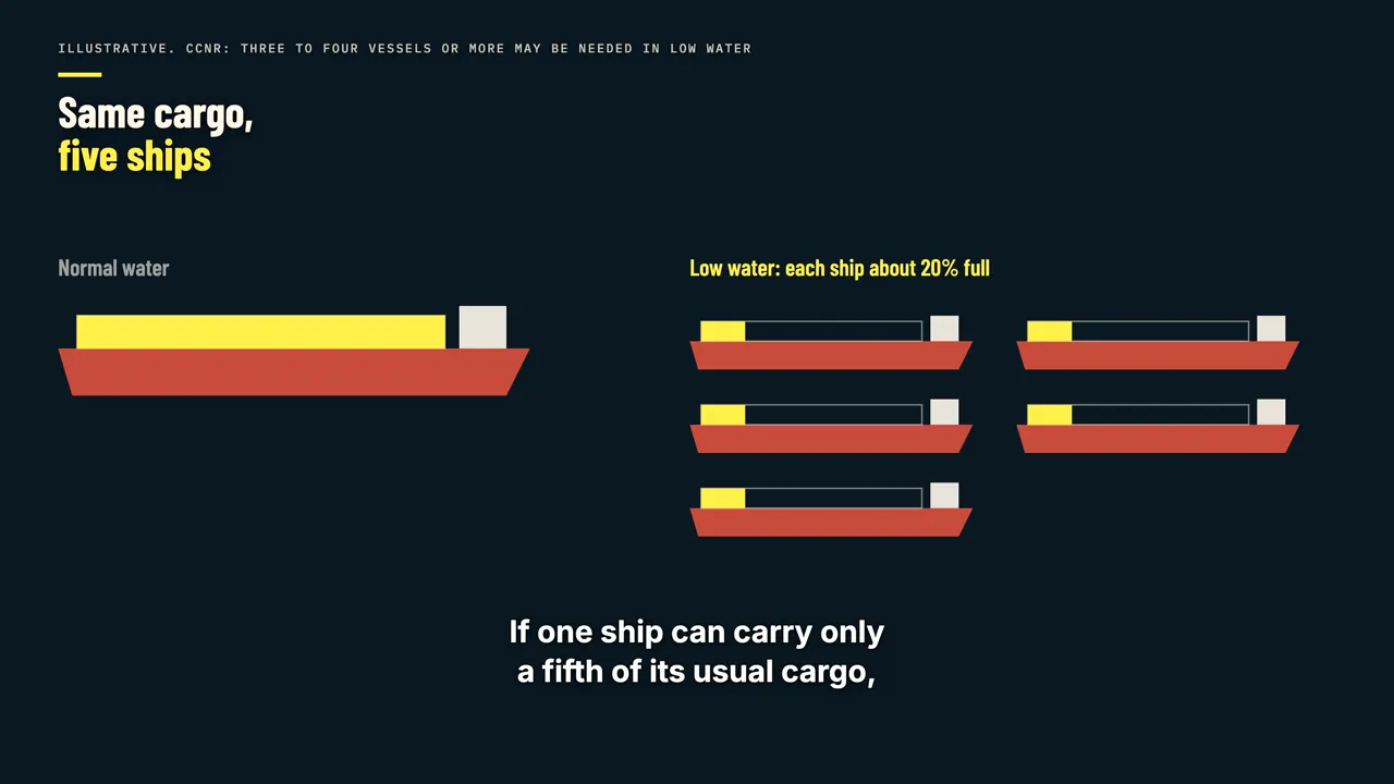
If one ship can carry only a fifth of its usual cargo, moving the same amount takes about five ships, or five trips. Space on ships suddenly becomes scarce, and its price jumps. In 2025 the Rhine carried about two hundred and eighty-two million tonnes of goods.
The commission notes that inland shipping normally earns almost no profit margin, except during periods of low water. Most of Germany's waterborne trade with other countries passes through Rotterdam, Antwerp and Amsterdam, about seventy-one percent of it in 2025.
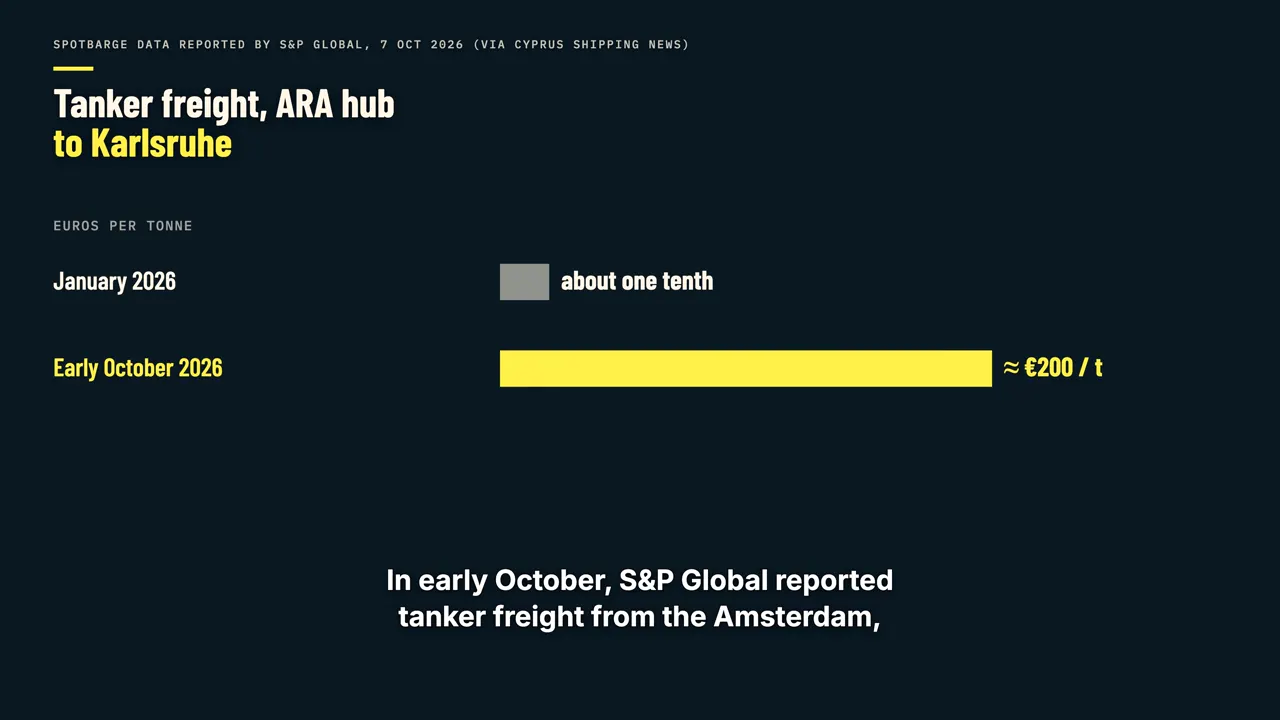
In early October, S&P Global reported tanker freight from the Amsterdam, Rotterdam and Antwerp hub to Karlsruhe at about two hundred euros per tonne. That was roughly ten times the rate in January. Container operators turn the same pressure into a surcharge tied directly to the reading at Kaub.
Contargo, a major container operator on the Rhine, charges one thousand and seventy-five euros extra per twenty-foot container once Kaub is at forty centimetres or below. Below eighty centimetres, it no longer promises to carry the cargo at all, and prices are negotiated case by case.
The end of the line
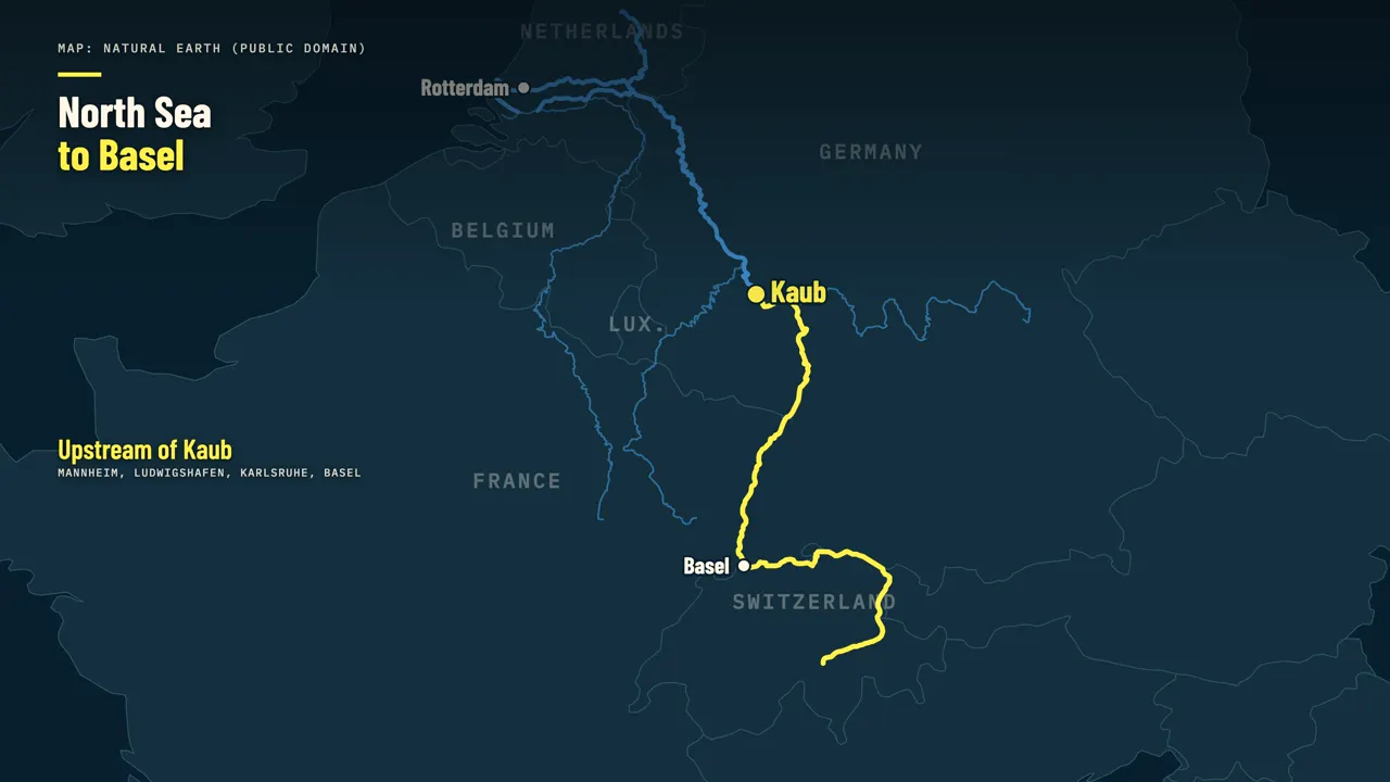
Switzerland sits at the far end of this route. Industry figures put the share of Swiss oil imports that arrive on the Rhine at about a fifth, and some estimates are higher. When barges arrive a quarter full, less fuel reaches the tanks in Basel each week.
Swiss heating oil rose from under one hundred and ten francs per hundred litres in June to more than one hundred and sixty by the end of September, according to Swiss press reports. The river is not the only reason.
Oil was already expensive this year because of disrupted tanker traffic through the Strait of Hormuz. The Rhine adds its own markup on top: higher freight, longer waits for delivery, and less fuel arriving per trip. The Swiss government's statement named both problems together:
the refinery outage, and weeks of restricted shipping on the Rhine.
Factories on the river
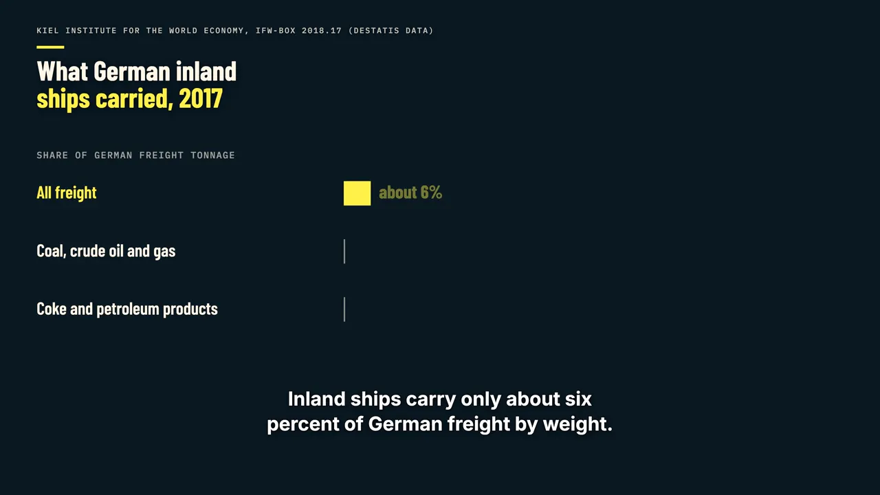
Germany feels it in its factories. Inland ships carry only about six percent of German freight by weight. But in 2017, according to the Kiel Institute, they carried twenty-eight percent of the coal, crude oil and gas, and twenty-one percent of the petroleum products.
About eighty percent of that inland shipping moves on the Rhine. BASF's main site in Ludwigshafen receives about half of its raw materials by inland ship, according to the German news agency dpa. Further down the river at Duisburg, Thyssenkrupp normally brings in about fifty thousand
tonnes of ore and coal a day by barge, and this summer it turned to chartered vessels with a shallower draft. A coal power plant on the Lower Rhine has reported limited output until the end of November because its coal deliveries are restricted. Power companies feel low water twice: coal deliveries slow down,
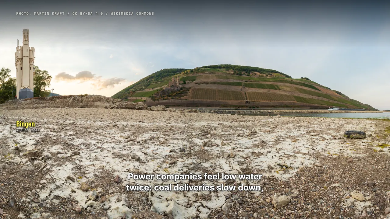
and hydropower falls when rivers run low. Bloomberg reported that hydropower output this year was down thirty-seven percent in Germany and twenty-eight percent in France compared with recent years. Replacing barges is hard.
A single fifteen-hundred-tonne barge carries about as much as sixty trucks, according to the chemical maker Covestro. A full block train carries roughly twelve to fifteen hundred tonnes, about one ordinary barge load.
The Kiel Institute measured the cost after the low water of 2018. Each extra day with Kaub below seventy-eight centimetres cut that month's growth in German industrial production by almost four hundredths of a percentage point. In 2018, that added up to more than half a percentage point in the third quarter alone.
Missing rain
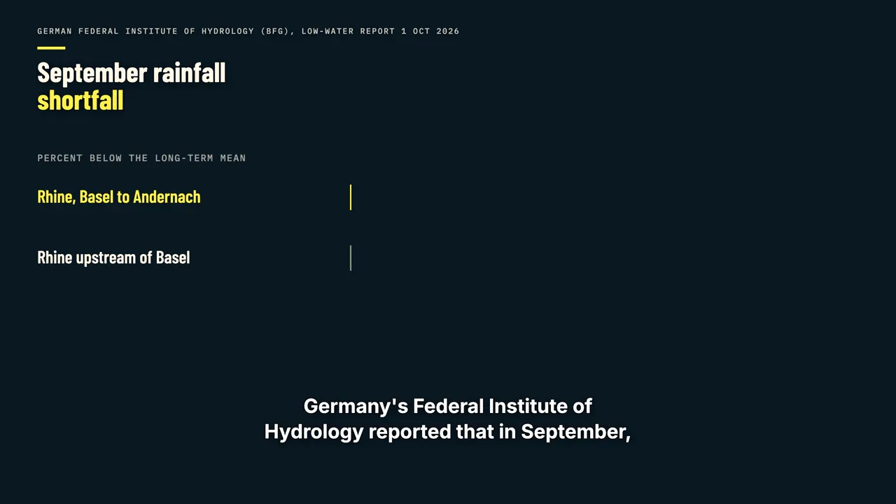
The cause is mostly missing rain. Germany's Federal Institute of Hydrology reported that in September, rainfall along the Rhine between Basel and Andernach was sixty-six percent below normal. Upstream of Basel, the shortfall was seventy-four percent.
Autumn is usually the low season for the Rhine, but this year it started from flows that were already very low after a hot, dry summer. Whether this one year is a sign of climate change is not something the gauge alone can answer. The Rhine commission notes that river flows reconstructed back to 1820 include other years
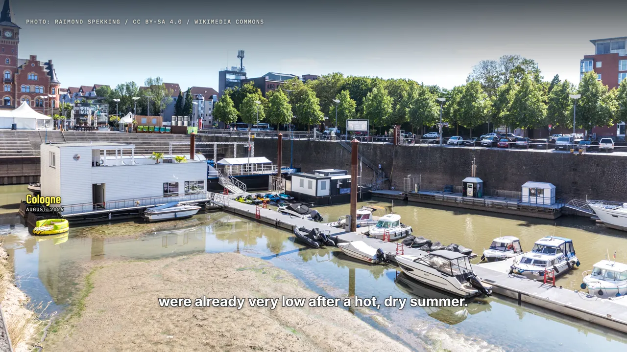
of severe low water. Researchers are still studying whether dry spells like this one are becoming more frequent, and a single record does not settle that.
Workarounds
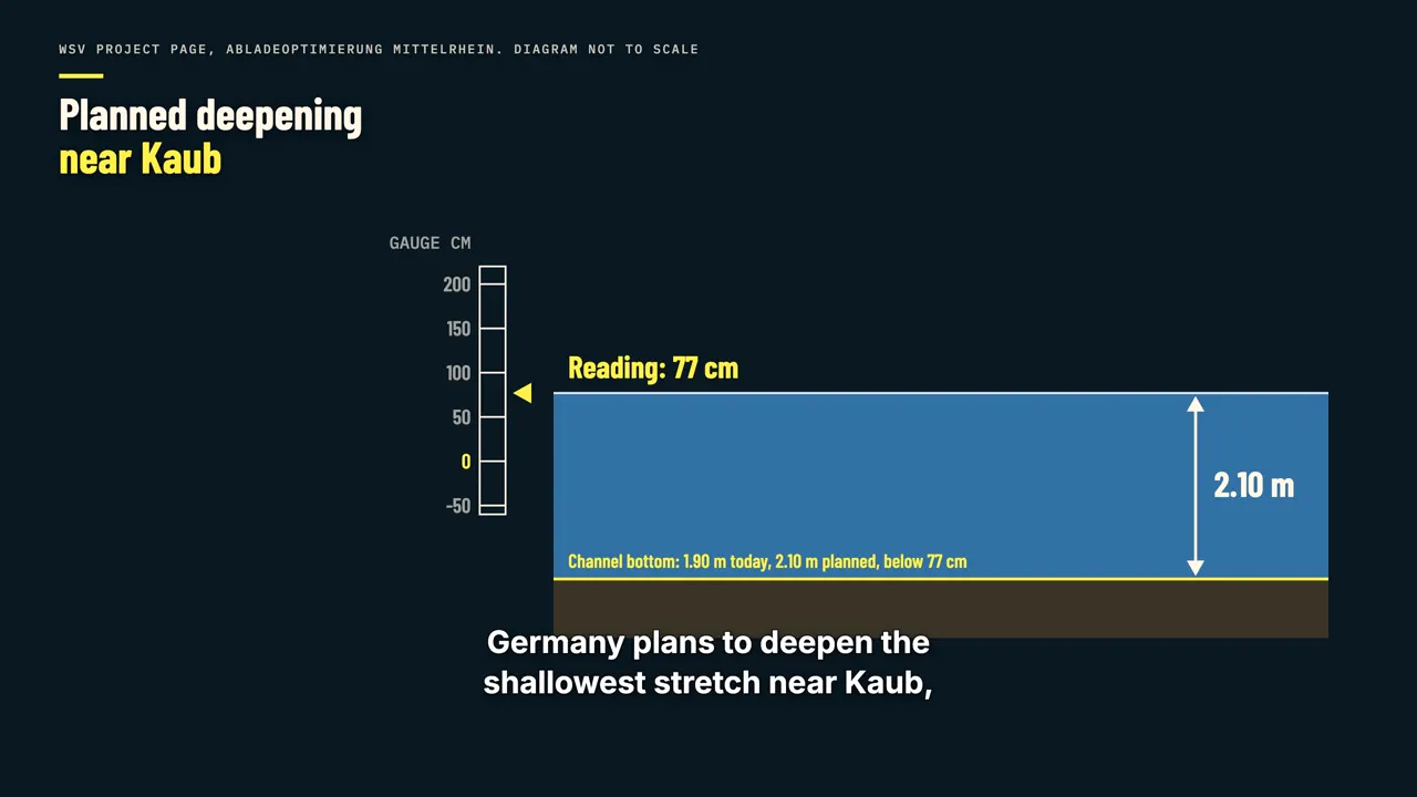
Germany plans to deepen the shallowest stretch near Kaub, from one metre ninety to two metres ten at the low-water reference level. The project has been in federal plans since 1992 and is still being planned. After the low water of 2022, BASF secured extra barges,
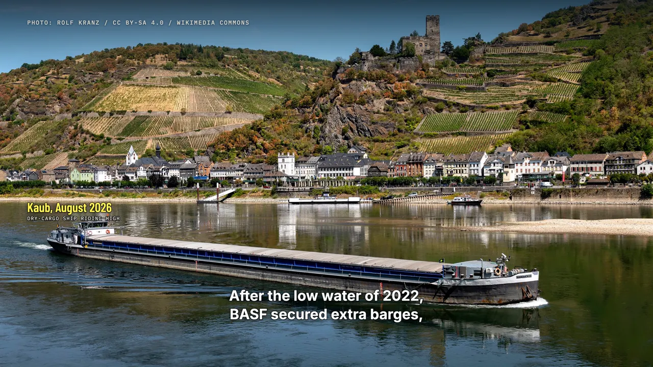
including vessels built for shallow water. Pipelines and rail carry most of Switzerland's fuel, which is why the government could say supply stayed secure while the river was constrained.
What decides the next weeks
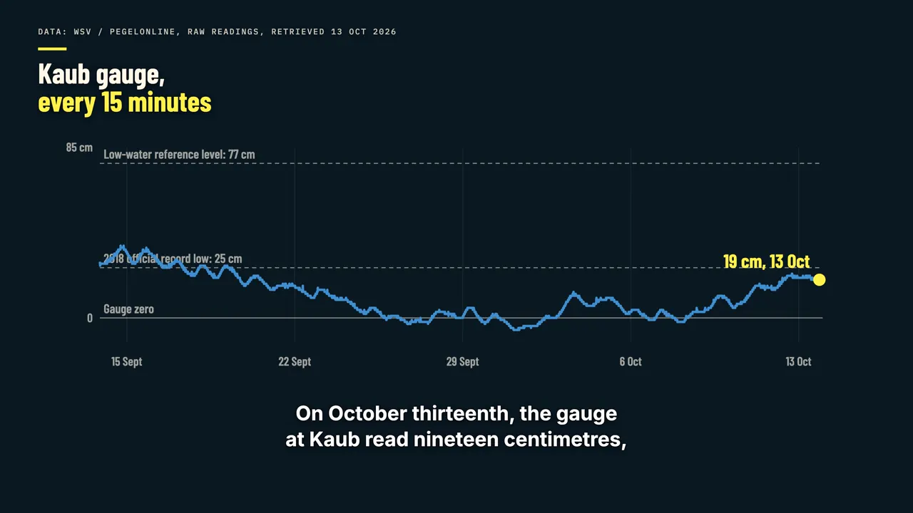
On October thirteenth, the gauge at Kaub read nineteen centimetres, a small rise after some rain. That is still almost sixty centimetres below the low-water reference level, and far below the one hundred and fifty centimetres Contargo lists for normal service.
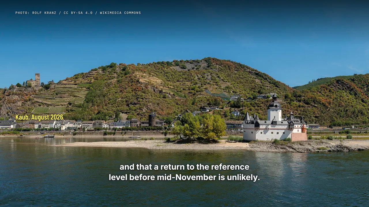
The hydrology institute says it does not expect a lasting end to the low water, and that a return to the reference level before mid-November is unlikely. So what happens next depends on three things: how much rain falls over the Alps and southern Germany, how long Kaub stays below about eighty centimetres,
and how much fuel buyers stored before winter. Until that number at Kaub climbs, everything that moves up the Rhine costs more to carry.
Watch on YouTube
Sources
- Kaub gauge readings (raw, unvalidated): WSV / PEGELONLINE, https://www.pegelonline.wsv.de
- German Federal Institute of Hydrology (BfG), low-water reports, Aug to Oct 2026: https://www.bafg.de
- Swiss Confederation, release of compulsory stocks, 21 Sep 2026: https://www.eda.admin.ch/de/newnsb/B9PaqlJnD0-G
- Central Commission for the Navigation of the Rhine, "Act now!" 3.0 (2023): https://www.ccr-zkr.org/files/documents/infovoienavigable/Act_now_3_0_en.pdf
- Kiel Institute for the World Economy, IfW-Box 2018.17: https://www.kielinstitut.de/fileadmin/Dateiverwaltung/IfW-Publications/-ifw/IfW_Box/2018/box_2018-17_niedrigwasser.pdf
- Contargo low-water surcharge, 12 Oct 2026: https://www.contargo.net/de/business/business-news/detail-business/pegelstaende-am-rhein-und-kleinwasserzuschlag-1/
- Reporting by Bloomberg, Reuters, dpa, AFP, S&P Global and Tagblatt as cited on screen.
- The 2026 gauge records are based on raw data that the German waterways agency had not yet validated at the time of production. Freight and price figures from news reports are labelled as reported.
- Map data: Natural Earth (public domain).
- Photos from Wikimedia Commons (file names as listed there):
- Rolf Kranz (CC BY-SA 4.0): Niedrigwasser Mittelrhein 2026 - GMS Danimex 2 vor Kaub; Niedrigwasser Mittelrhein 2026 - Loreley und Betteck mit GMS Emanuel IV und Blacklock; Niedrigwasser Mittelrhein 2026 - GMS Pelikaan vor Oberwesel; Niedrigwasser Mittelrhein 2026 - Kaub und Burg Pfalzgrafenstein; Extremniedrigwasser Rhein bei Lorch mit Ruine Fürstenberg (Oktober 2026); Burg Pfalzgrafenstein und Burg Gutenfels bei Extremniedrigwasser 2026
- Marion Halft (CC BY-SA 4.0): Das wilde Gefähr Niedrigwasser Rhein September 2026; Pegel Kaub Niedrigwasser 2026 Nullpunkt Zusatzpegel (001); Pegel Kaub Niedrigwasser 2018 (04); Pegel Kaub Niedrigwasser 2018 (03); Pegel Kaub Niedrigwasser 2026 (001); Mittelrhein Rhein Niedrigwasser August 2026; Oberwesel Jungferngrund Niedrigwasser Rhein 2018 (01)
- LID (CC BY-SA 2.0): Rheinhafen Basel (11833995754)
- Martin Kraft (CC BY-SA 4.0): MKr12580-84 Niedrigwasser 2022 (Mäuseturm Bingen)
- Raimond Spekking (CC BY-SA 4.0): Rhein in Köln bei Niedrigwasser 2026-7445; Rhein bei Leverkusen-Wiesdorf bei Niedrigwasser 2026-7659; Tankschiff Blue Dina - ENI 02339328 - auf dem Rhein in Köln-1068; Tankschiff Vigila - ENI 02340580 - auf dem Rhein in Köln-7435
- Alexander Hoernigk (CC BY 3.0): Bingen Rhein Contargo II 2012-05-13 15.35.40
- Steffen Schmitz (CC BY-SA 4.0): Duisburg, duisport, 2020-03 CN-01
- Jedesto (CC BY-SA 4.0): Hafen Duisburg-Ruhrort von Karl-Lehr-Brücke
- Unknown author (CC BY-SA 4.0): Kaub Pegel Hochwasser Februar 1970
- Willem van de Poll (CC0): Loodsen bij de peilschaal van de Rijn bij Kaub, Bestanddeelnr 254-1571
- Whgler (CC BY-SA 4.0): Panorama Rhein bei Kaub 2022
- Jörg Braukmann (CC BY-SA 4.0): Burg Katz und Loreley
- Achim Lammerts (Syntaxys) (CC BY-SA 4.0): 2026-04-08 Rhein Ludwigshafen Mannheim (D500-97327M) by Achim Lammerts
- Licences: https://creativecommons.org/licenses/