Why Flights Over Greenland Look Like a Detour on a Flat Map
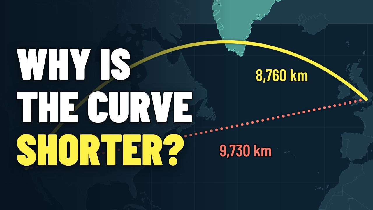
Fly from Los Angeles to London and the plane on the seat-back map swings north over Canada and Greenland. On a flat map that looks like a detour. On a globe it is the shortcut: about 8,760 km instead of 9,730 km for a steady compass heading.
This video explains why: Mercator's 1569 map for sailors, why Greenland looks as big as Africa (Africa is about 14 times larger), why no flat map can be honest, great circles and the gnomonic chart, the jet stream and the North Atlantic Tracks, ETOPS rules for twin-engine jets, the first polar airline route in 1954, and how the closure of Russian airspace sends Finnair over the Arctic today. It also covers the UN General Assembly's September 2026 "Correct the Map" resolution.
This article is the full narration of the video. Watch on YouTube
Why do planes fly over Greenland?
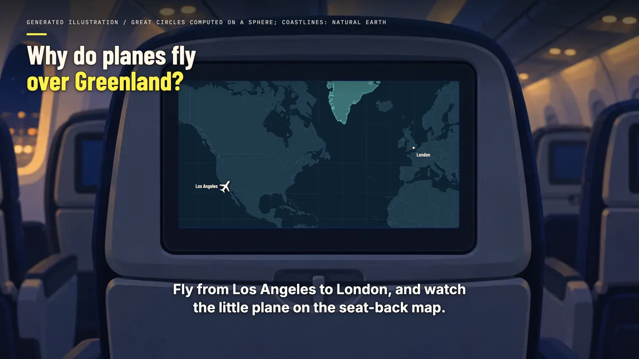
Fly from Los Angeles to London, and watch the little plane on the seat-back map. You'd expect it to head east across America, then straight over the Atlantic. Instead, it usually swings north, over Canada and Hudson Bay, and crosses the southern end of Greenland. On a flat map, that looks like a huge detour.
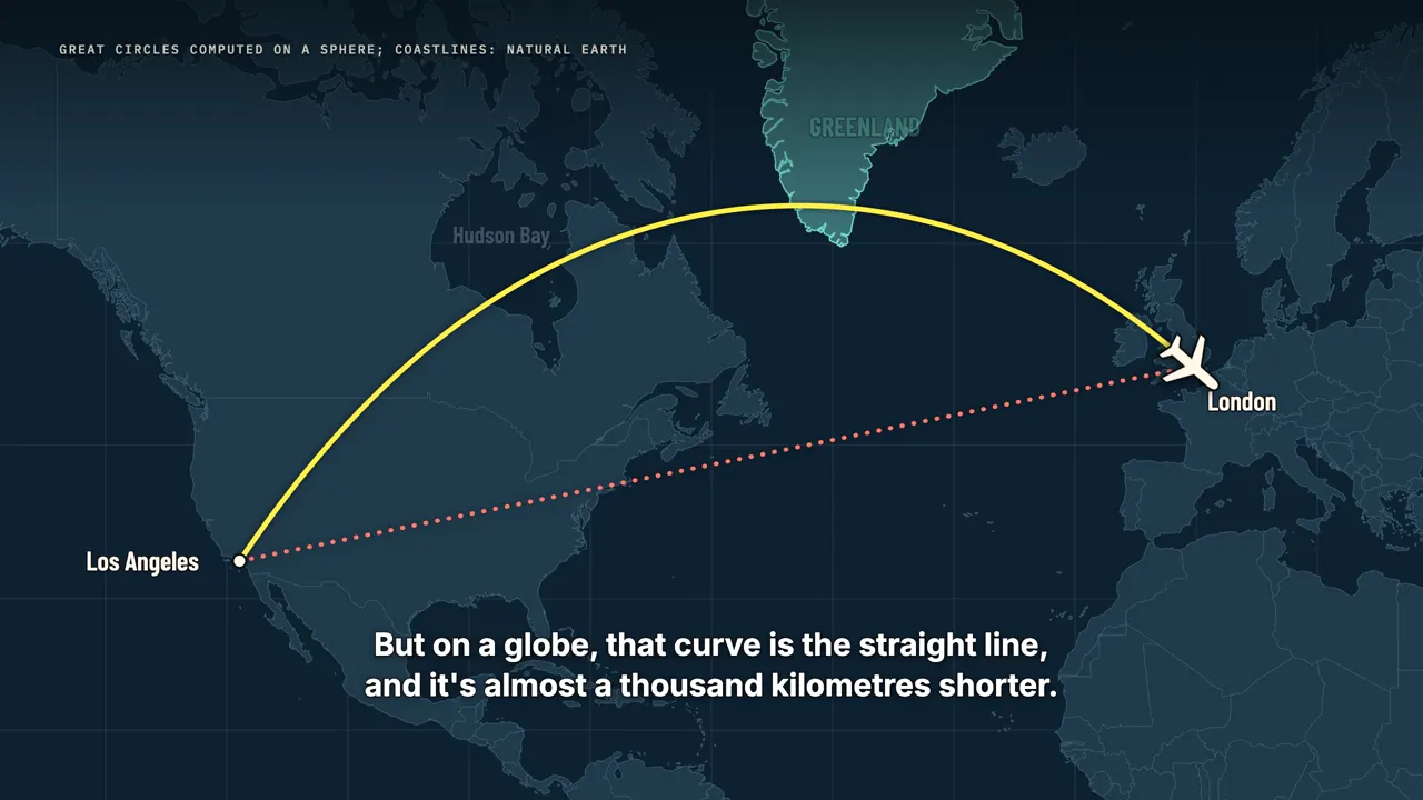
But on a globe, that curve is the straight line, and it's almost a thousand kilometres shorter. The plane isn't taking the long way. The map is. Last month, that same map even reached the United Nations, which urged the world to use maps that show Africa at its true size.
A map for sailors
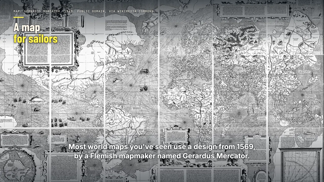
Most world maps you've seen use a design from 1569, by a Flemish mapmaker named Gerardus Mercator. He made it for sailors. A ship crossed the ocean by holding one compass heading, say northeast, for days at a time. On Mercator's map, any steady heading is a straight line.
So a navigator could lay a ruler between two ports, read the angle, and steer by it. But to make that work, the map has to stretch. On a globe, the lines of longitude squeeze together and meet at the poles. Mercator pulled them apart into straight, parallel lines, which stretches everything sideways the farther you go from the equator.
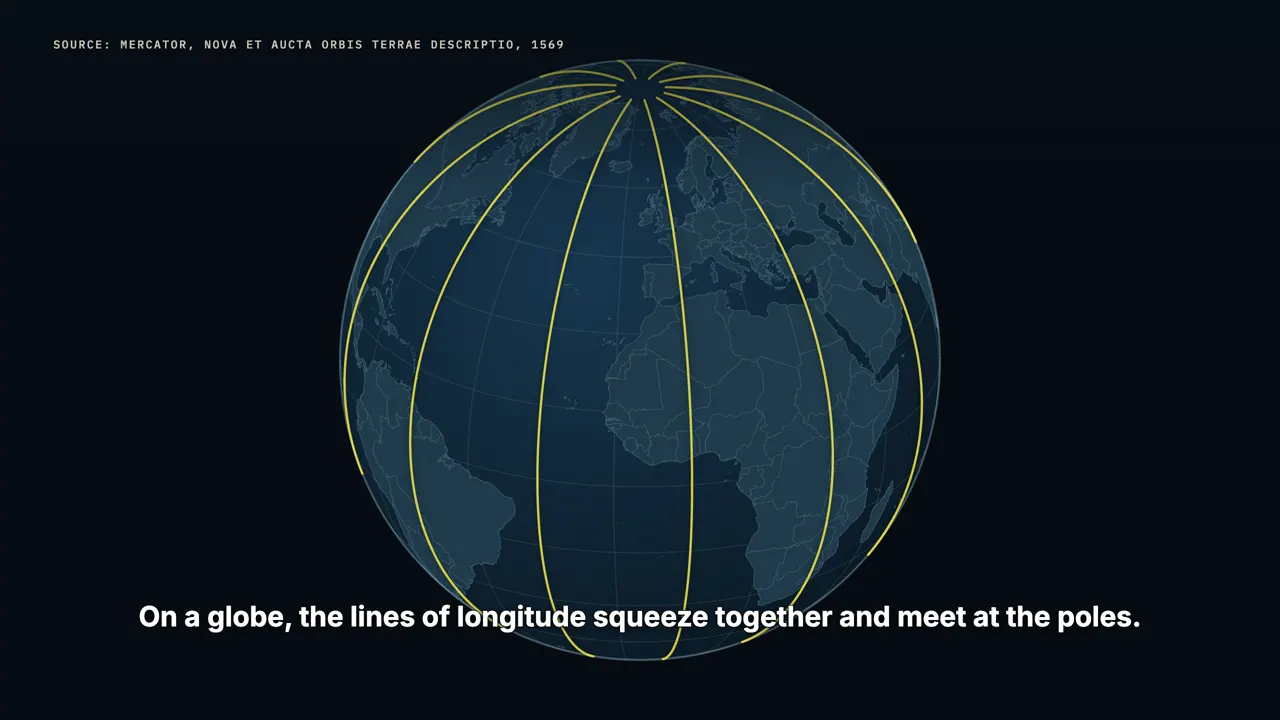
Then, so shapes wouldn't look squashed, he stretched them up and down by the same amount. Near the equator, the stretch is small. At sixty degrees north, everything is drawn twice as wide and twice as tall. Almost all of Greenland sits even farther north than that.
The true size of Greenland
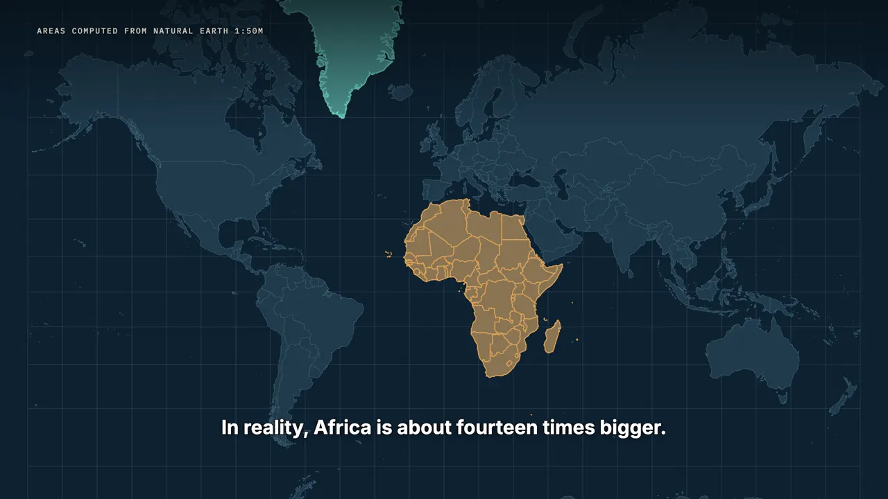
On this map, Greenland looks about as big as Africa. In reality, Africa is about fourteen times bigger. Slide Greenland down to the equator, and watch it shrink. It ends up a little smaller than the Democratic Republic of the Congo.
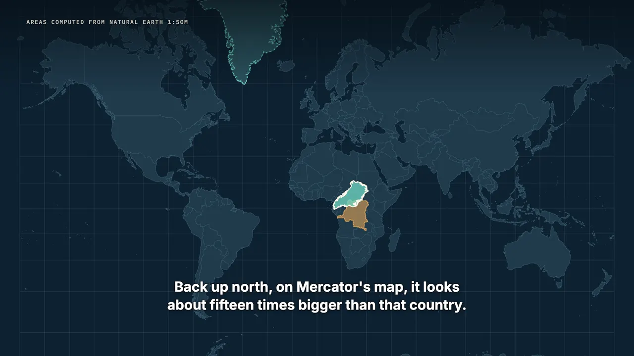
Back up north, on Mercator's map, it looks about fifteen times bigger than that country. Canada and Russia get the same treatment, and Antarctica becomes an endless white strip along the bottom.
No flat map is honest

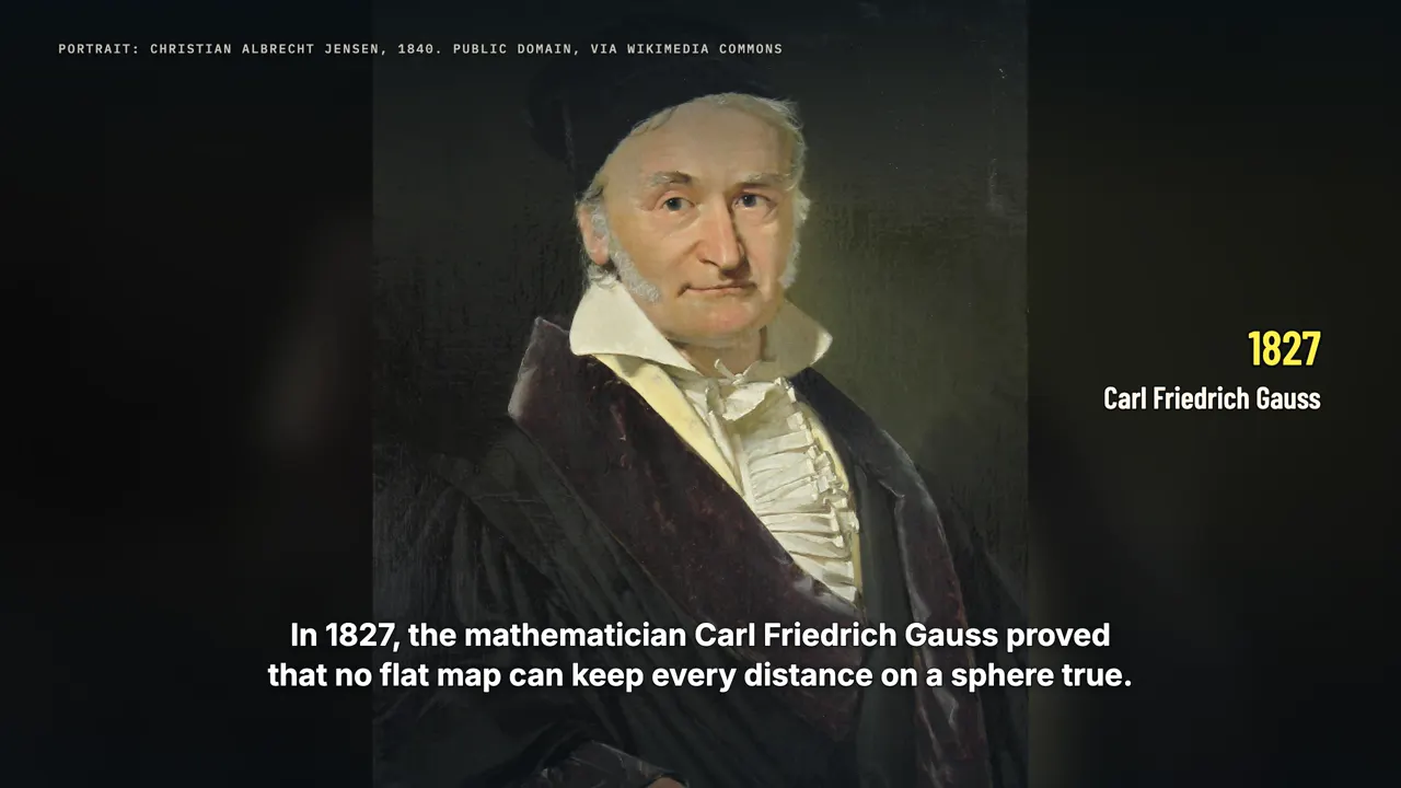
None of this is a mistake. Peel an orange and try to press the peel flat. It tears, or it stretches. In 1827, the mathematician Carl Friedrich Gauss proved that no flat map can keep every distance on a sphere true.
Every map has to give something up. Mercator kept angles right and let sizes go. That trade was perfect for sailors with compasses. It's terrible for judging which way is shortest.
Why we still use it
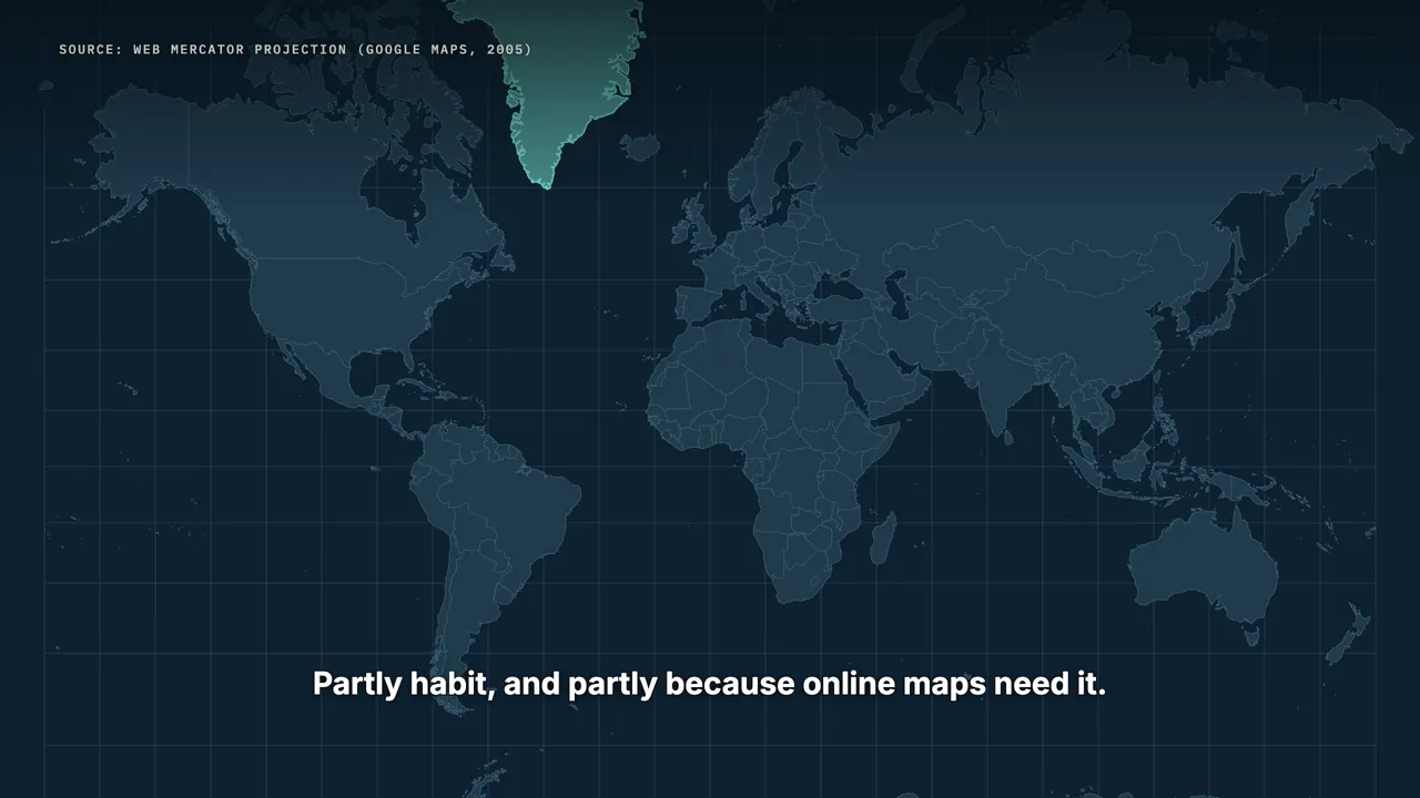
So why do we still look at Mercator's map every day? Partly habit, and partly because online maps need it. When Google Maps launched in 2005, it used a version of Mercator, now called Web Mercator. Zoomed in on a street, Mercator keeps shapes true, so corners stay square and turns look like turns.
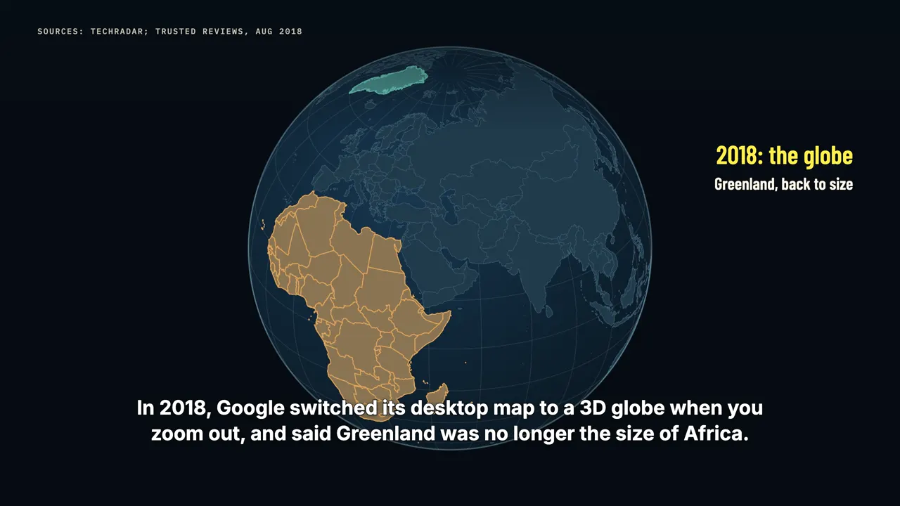
It also turns the whole world into one big square that can be cut into tiles. But zoom all the way out, and Greenland swells again. In 2018, Google switched its desktop map to a 3D globe when you zoom out, and said Greenland was no longer the size of Africa. That's partly why, in August 2025, the African Union backed a campaign called Correct The Map.
Then, on September 4, 2026, the UN General Assembly passed a resolution built on it, 164 votes to 1. It encourages governments, schools and tech companies to use equal-area maps, like the Equal Earth projection, whenever size matters. It doesn't ban Mercator, and the minister who led it says the old map is still useful for navigation.
The string on the globe
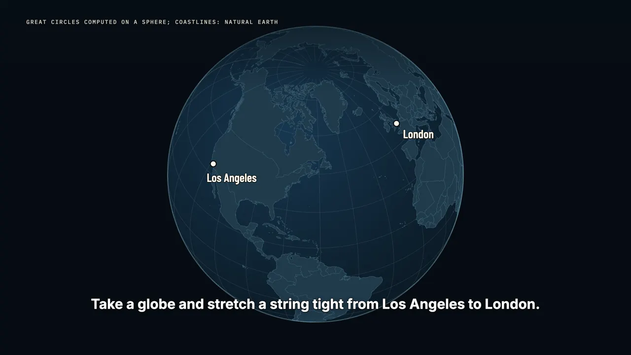
So what is the shortest path between two cities on a ball? Take a globe and stretch a string tight from Los Angeles to London. The string doesn't follow the steady compass heading. It bows north. That path lies on a great circle: a circle that cuts the Earth into two equal halves, like slicing an orange right through its middle.
The equator is a great circle, and so is every line of longitude. But the other lines of latitude are not. They're smaller circles that ring the poles. The shortest route between two places always runs along a great circle. And for two cities in the north, that circle bends toward the pole, because up there, the world is narrower.
Going once around the Earth at the equator is about 40,000 kilometres. At London's latitude, a full lap is only about 25,000. The great circle cuts across that narrow top of the world instead of going the wide way around. From Los Angeles to London, it's about 8,760 kilometres.
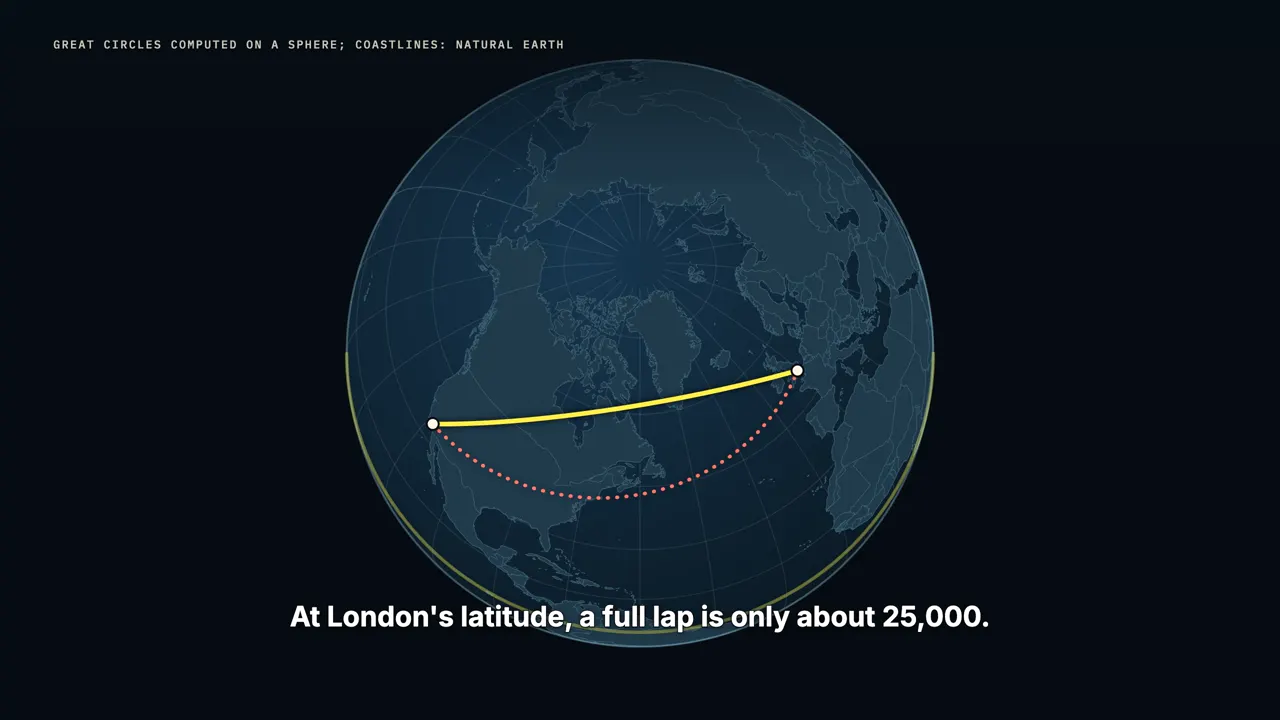
Holding one steady heading, the straight line on Mercator's map, it's about 9,730. That's nearly a thousand kilometres more, roughly an extra hour in the air. On the great circle, the compass heading never stays still. The flight leaves Los Angeles pointing north-northeast, and reaches London pointing southeast.
The steady-heading route would point a little north of east the whole way, and simply take longer.
A map where the shortcut is straight
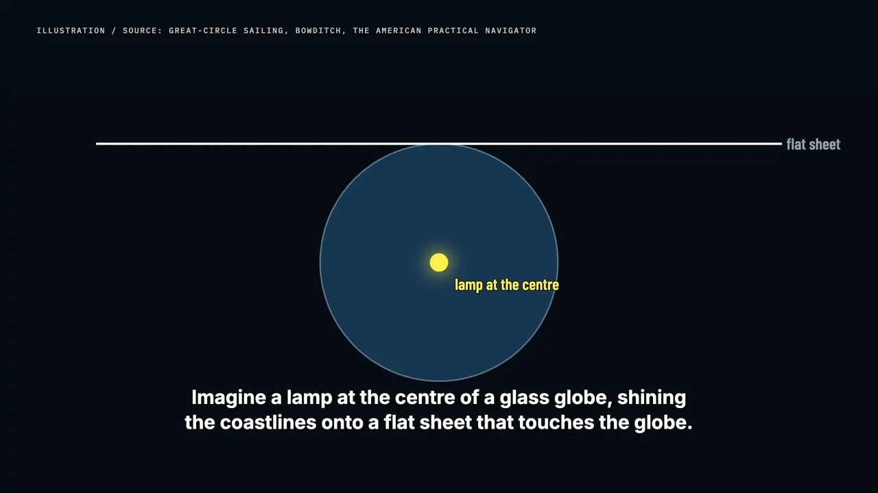
There is a map where the great circle really is a straight line. Imagine a lamp at the centre of a glass globe, shining the coastlines onto a flat sheet that touches the globe. That's the gnomonic projection. Every great circle passes through the centre of the Earth, so its shadow on the sheet is a straight line.
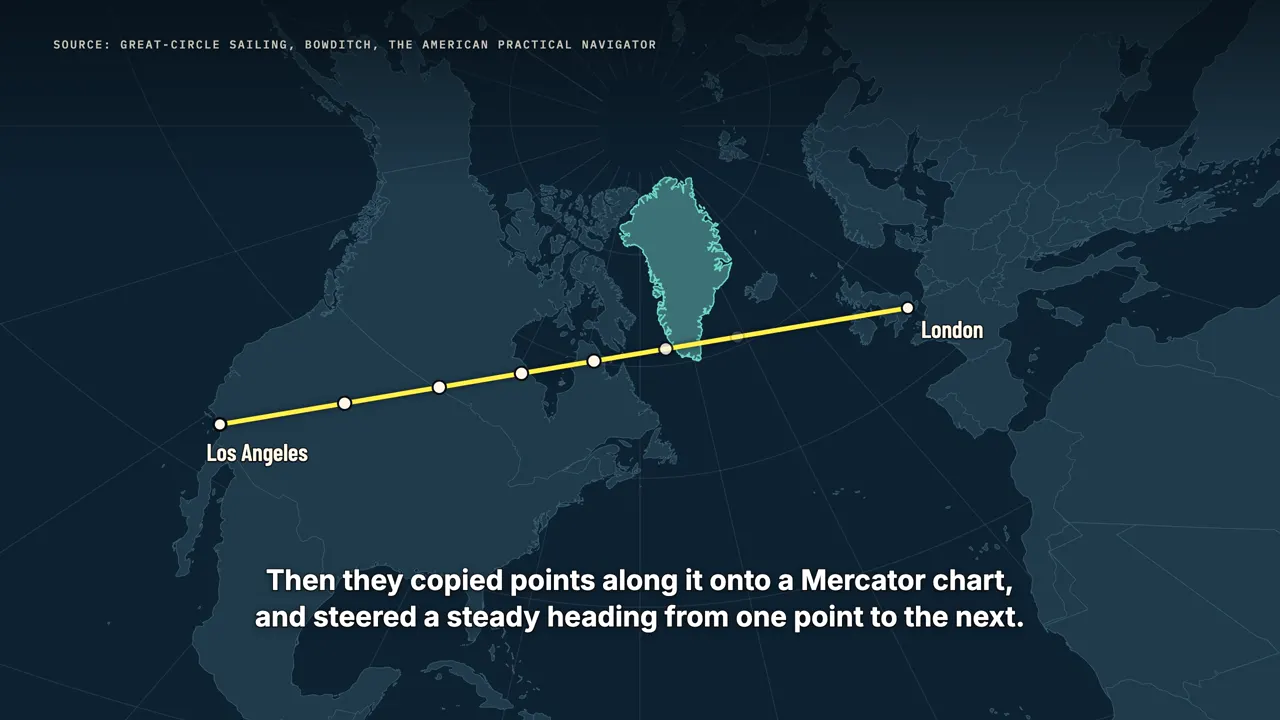
Navigators drew their route with a ruler on this kind of chart. Then they copied points along it onto a Mercator chart, and steered a steady heading from one point to the next. On the gnomonic map, Los Angeles to London is a single straight line, through Hudson Bay and across the bottom of Greenland. The price is everything else: shapes swell toward the edges, and the map can never show even half the world.
Shortcuts everywhere
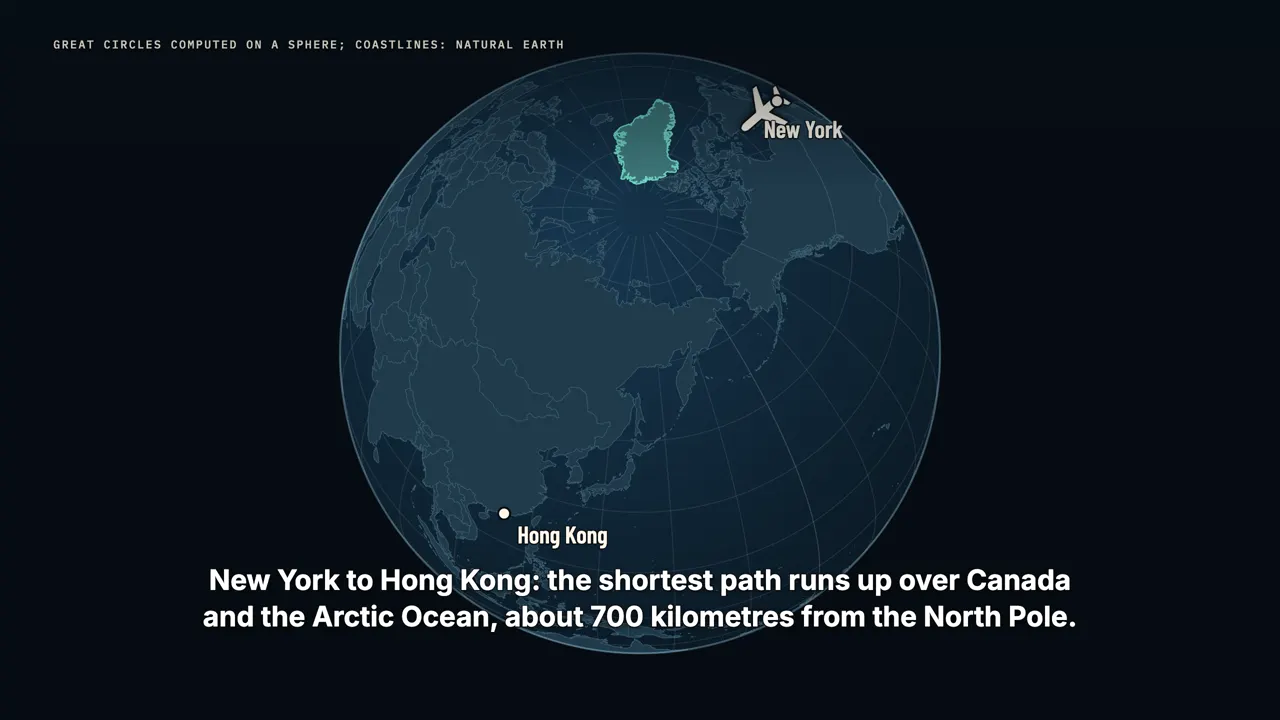
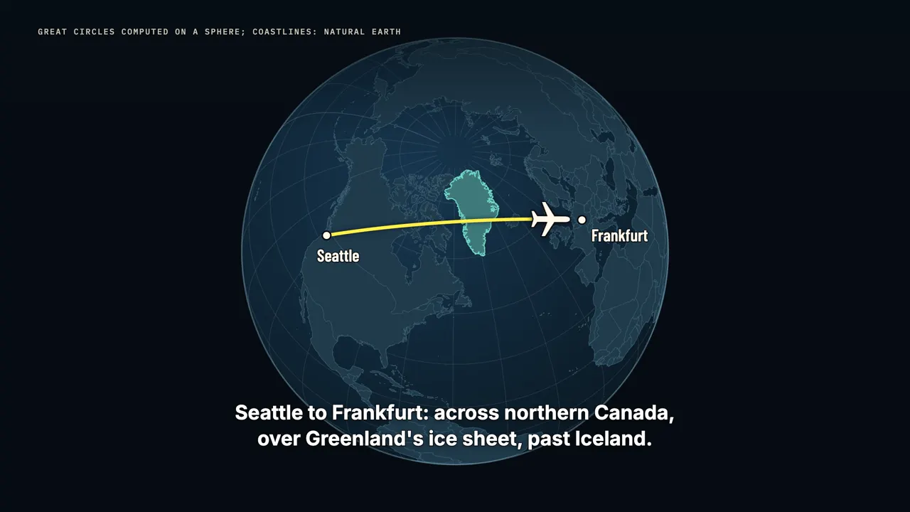
Once you see it, it shows up everywhere. New York to Hong Kong: the shortest path runs up over Canada and the Arctic Ocean, about 700 kilometres from the North Pole. Chicago to Delhi: up over Greenland and the Arctic, then down through Central Asia. Seattle to Frankfurt: across northern Canada, over Greenland's ice sheet, past Iceland.
It works in the south too. Sydney to Santiago dips to almost sixty-two degrees south, as far south as the islands off Antarctica's peninsula. On a flat map, all of these look like wild detours. On a globe, they're the shortcuts.
The wind gets a vote
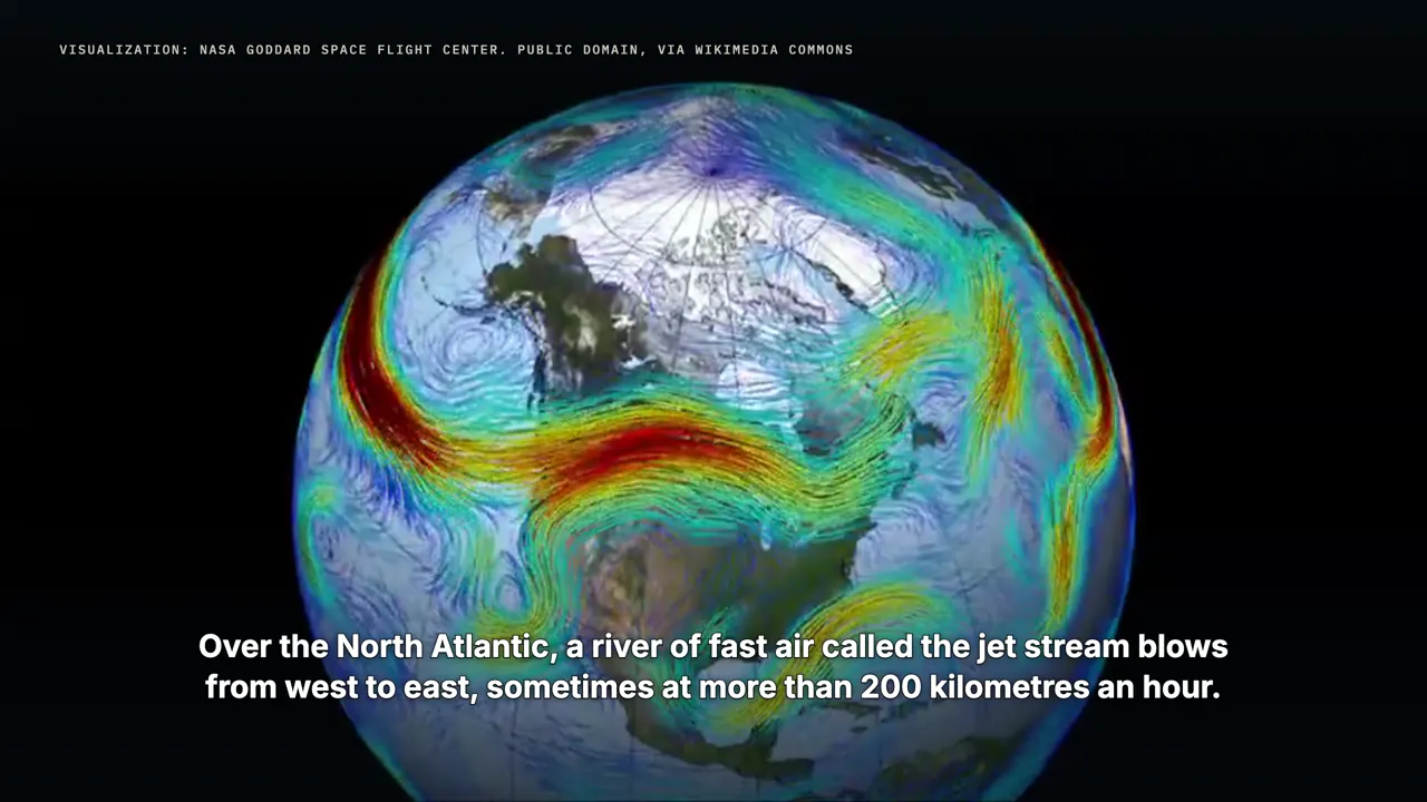
Real flights don't follow the great circle exactly. Over the North Atlantic, a river of fast air called the jet stream blows from west to east, sometimes at more than 200 kilometres an hour. Eastbound planes ride it for a free push. Westbound planes steer around it, often hundreds of kilometres to the north.
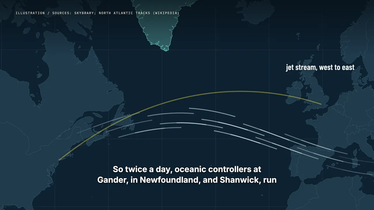
So twice a day, oceanic controllers at Gander, in Newfoundland, and Shanwick, run from Prestwick in Scotland, publish a fresh set of one-way lanes across the ocean. They're called the North Atlantic Tracks, and they're drawn around that day's wind. The fastest route is the great circle, bent by the weather.
What if an engine fails?
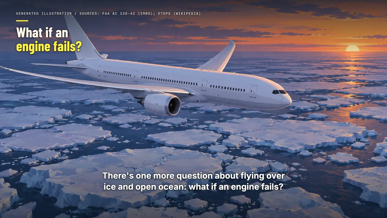
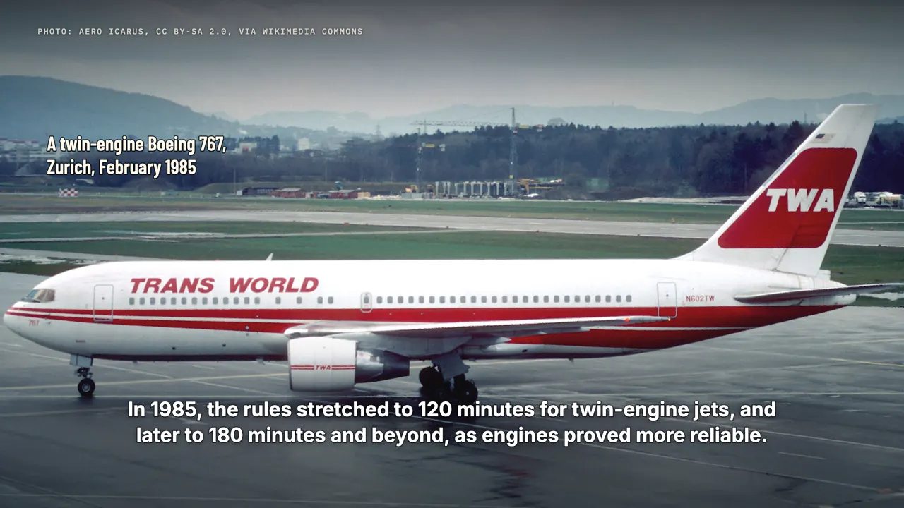
There's one more question about flying over ice and open ocean: what if an engine fails? For decades, American rules kept two-engine airliners within sixty minutes of an airport. The longest ocean and Arctic crossings belonged to jets with three or four engines. In 1985, the rules stretched to 120 minutes for twin-engine jets, and later to 180 minutes and beyond, as engines proved more reliable.
These are the ETOPS rules, and they're a big reason a two-engine jet can take the shortcut today. Greenland is part of the safety net. Its airports at Kangerlussuaq and Narsarsuaq are offered as places for transatlantic twin-jets to divert.
The first polar flight
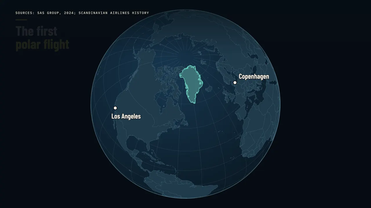
Airlines figured out the shortcut long before jets. On November 15, 1954, Scandinavian Airlines began flying a polar route from Copenhagen to Los Angeles. The propeller plane stopped in Greenland, at Søndre Strømfjord, now called Kangerlussuaq, and in Winnipeg, Canada. Passengers were handed snowsuits and a manual on surviving in the Arctic.
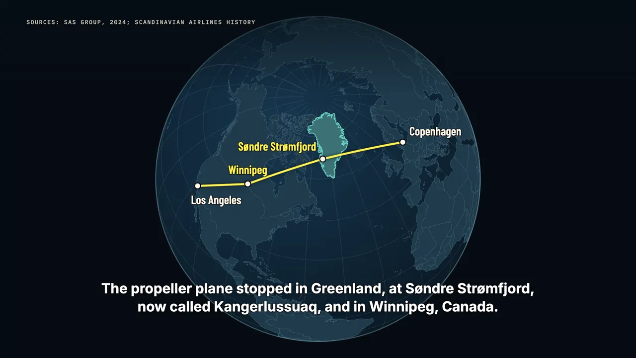
The route cut thousands of kilometres, and it became popular with Hollywood stars.
The shortcut you can't take
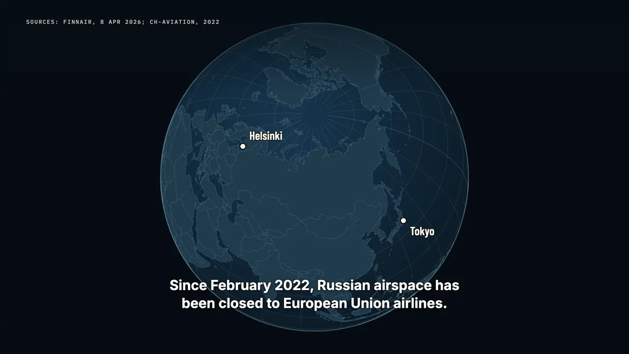
The same geometry still shapes the news. Since February 2022, Russian airspace has been closed to European Union airlines. The shortest path from Helsinki to Tokyo runs straight across Russia. So Finnair flies either a long southern detour through Central Asia, or a route up over the Arctic.
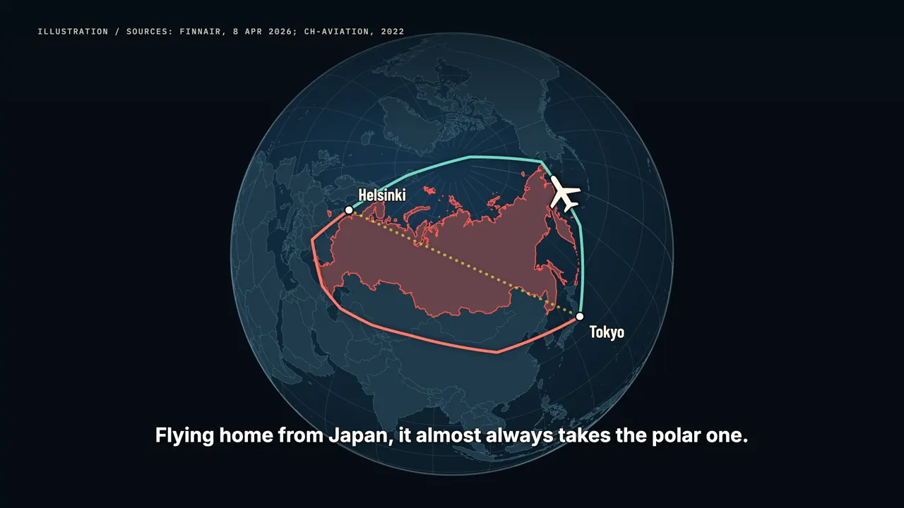
Flying home from Japan, it almost always takes the polar one. Its flights to Japan now take two to four hours longer than before. Finnair has done this before. In 1983, when Soviet airspace was closed to it, it flew the first non-stop service from Europe to Japan, over the North Pole.
A straight line on a round planet
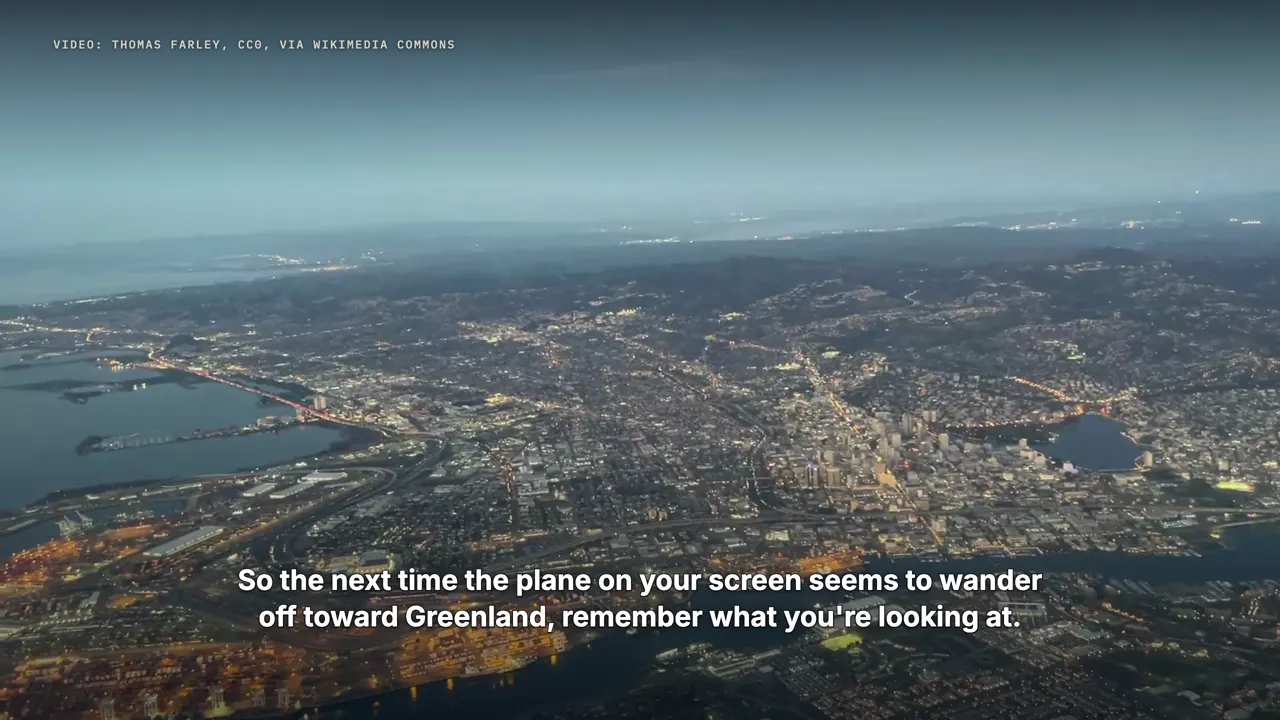
So the next time the plane on your screen seems to wander off toward Greenland, remember what you're looking at. It's a straight line on a round planet, drawn on a flat map. The plane knows the shortcut. The map just can't show it.
Watch on YouTube
Sources
- Mercator 1569 world map; Mercator projection (Wikipedia)
- Gauss, Theorema Egregium, 1827 (Wikipedia)
- Web Mercator projection (Wikipedia); Google Maps globe view: TechRadar and Trusted Reviews, Aug 2018
- African Union endorses Correct The Map: Africa.com, 14 Aug 2025
- UN General Assembly resolution, 4 Sep 2026 (164-1-6): https://news.un.org/en/story/2026/09/1168284
- Gnomonic projection (Wikipedia); great-circle sailing, Bowditch, The American Practical Navigator
- Ask the Pilot (Patrick Smith), great circles: https://askthepilot.com/questionanswers/great-circles/
- SKYbrary, North Atlantic Organised Track System; North Atlantic Tracks (Wikipedia)
- ETOPS (Wikipedia); FAA Advisory Circular 120-42 (1985)
- Mittarfeqarfiit (Greenland Airports), ETOPS alternates
- SAS Group press release, 2024 (first polar route, 15 Nov 1954); Scandinavian Airlines (Wikipedia)
- Finnair, "Avoiding Russian airspace", 8 Apr 2026; ch-aviation, 2022
- Natural Earth: https://www.naturalearthdata.com